A Detailed Account on Archaeological Methods
Prehistoric as well as historic events employ archaeological methods such as field survey, excavation, remote sensing, and drones among others. Know them in detail here.
In order to study the human activity in history and prehistory, the archaeologists make use of archeological investigation that generally involves different phases that further involve various methods.
Ahead of any practical work, a clear objective is set and looked upon. After that, site surveying is done to figure out as much possible about it and the nearby area. Then an excavation may be carried out to discover any archaeological elements deep beneath the ground. The data obtained from the excavation is studied and estimated to accomplish the original objectives.
Let’s now look at the archaeological methods in detail here.
1. Remote Sensing
Just before digging up a location, remote sensing can be used for tracking down a site’s location within a large area or providing more information about sites or regions. Passive and active are two types of remote sensing instruments. Passive instruments sense the energy or radiation reflected or emitted by the object from a source rather than an instrument. Active instruments emit energy and record the reflected.
LiDAR or Light Detection and Ranging is an active instrument using laser for transmission of a light pulse and a receiver with sensitive detectors for measuring the backscattered or reflected light. The distance to the object is calculated by recording the time between the transmitted and backscattered pulses and using the speed of light. Lidars help in finding out the atmospheric profiles of aerosols, clouds, and other atmospheric elements. (8.1)
Laser Altimeter is another active instrument that makes use of lidar for measuring the height of the instrument platform above the surface. The topography of the underlying surface can be calculated by learning about the platform’s height with respect to the mean Earth's surface.
2. Field Survey
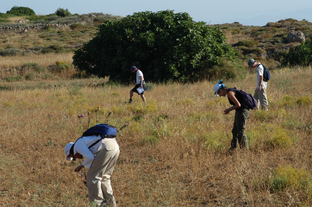
After remote sensing, a field survey is conducted. A regional survey intends to methodically locate previously undiscovered sites in a region. Site survey sims to locate elements of interest in a site. A Surface survey is the simplest survey technique that involves combining an area on foot using mechanized transport for searching features or artifacts seen on the surface. It doesn’t uncover the sites or features that are buried deep beneath the Earth or have overgrown with vegetation. Mini-excavation techniques including corers, augers, and shovel test pits are included in the surface survey.
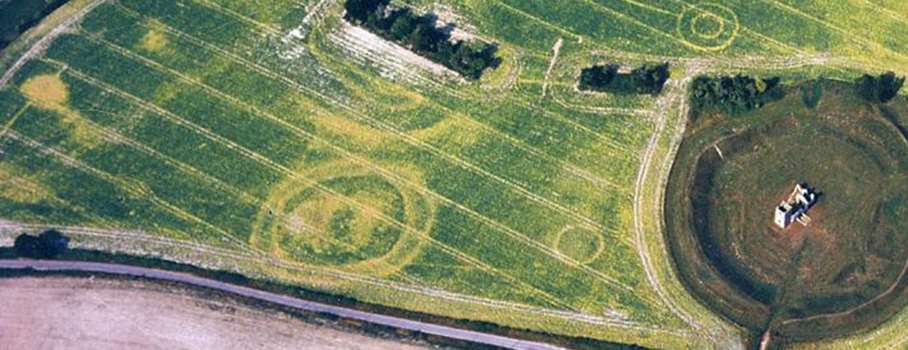
Aerial survey is another kind of survey carried out using cameras connected to balloons, UAVs, airplanes, or kites. A bird’s-eye view is especially crucial for the swift mapping of vast, complex sites. The aerial photographs are used for documenting the status of the archaeological dig. Also, aerial imaging can help in detecting several things not visible from the surface. Pictures of ripening grain exhibiting color change at the time of maturation have uncovered buried structures with much precision. Aerial survey also uses UV, infrared, LiDAR, ground-penetrating radar wavelengths, and thermography.
Another form of survey named geophysical survey can be great for seeing under the ground. Magnetometers help in discovering subtle deviations in Earth’s magnetic field caused due to iron artifacts, kilns, some stone structures, and eve middens and ditches. The devices measuring soil’s electrical sensitivity are also used. The archaeological features whose electrical resistivity differs from that of surrounding soils can be detected and mapped.
Regional survey in underwater archaeology makes use of geophysical or remote sensing devices such as marine magnetometer, side-scan sonar, or sub-bottom sonar. Sterkfontein caves were dynamited in the late 1980s and excavation was carried out by miners in search of limestone.
3. Excavation
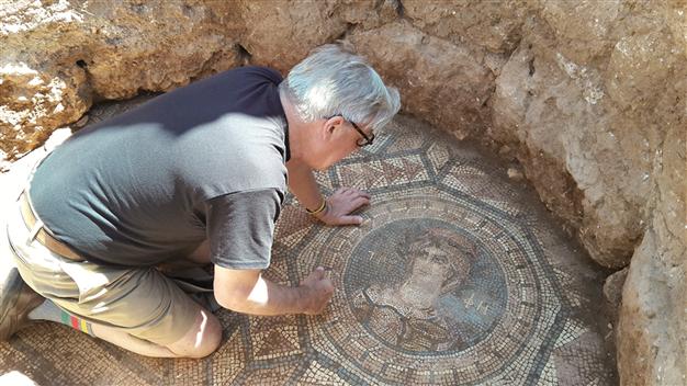
Modern excavation techniques require the precise locations of objects and features to be recorded. This includes identifying horizontal locations and sometimes vertical positions also. Their association or relationship with nearby objects and features also needs to be recorded for later analysis.
This helps archaeologists in figuring out which artifacts and features were used together and which may be from distinct archaeological phases of activity. Stratigraphy is uncovered using a site’s excavation in case of a site that was occupied by a succession of different cultures.
4. Post-Excavation Analysis
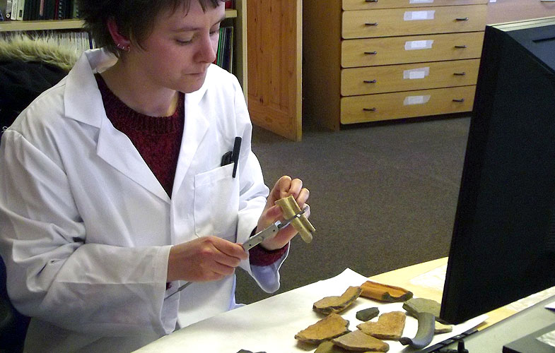
After the excavation of artifacts and structures has been carried out, a post-excavation analysis is done. Being the most-time consuming part, the final excavation for major site reports takes years to be published.
At the basic level of analysis, artifacts are discovered to be clean, categorized, and compared to published collections. This process of comparison involves topological categorization and identifies other sites with similar artifact collections.
Moreover, archaeological science offers a far more comprehensive range of analytical techniques available and allows the dating of artifacts. Plants, bones, and pollen gathered from a site can be analyzed through methods of zooarchaeology, paleoethnobotany, and palynology.
5. Computational & Virtual Archaeology
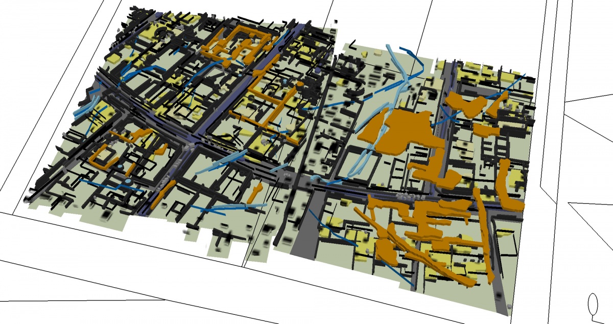
Computer graphics help in building virtual 3D models of sites. Photogrammetry is also used as an analytical tool. Digital topographical models combined with astronomical calculations are used for verifying whether certain structures were aligned with astronomical events or not.
Agent-based modeling and simulation can be used for clearly understanding the past social dynamics and aftermath. Data mining is applicable to huge bodies of archaeological 'grey literature'.
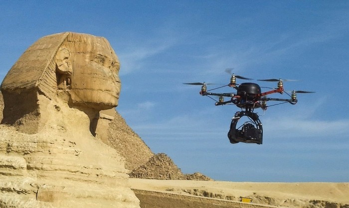
6. Drones
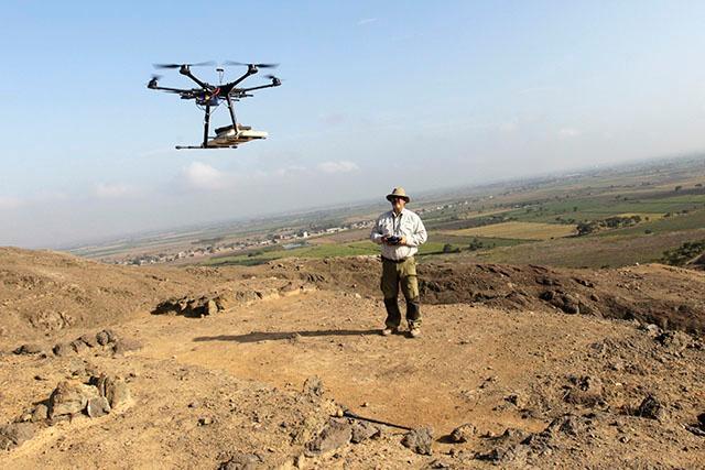
Around the world, archaeologists make use of drones for speeding up survey work and protecting sites from squatters, builders, and miners. For instance, small drones helped Peru researchers in producing 3D models of Peruvian sites rather than the usual flat maps within a few days or weeks.
Popular Posts
Top 10 Sharpest & Deadliest Swords In History
In classic mythological movies, books and television, we’ve seen those audacious sword-wielding heroes smiting the enemi...
Augustus Perez
List of Water Deities from Different Mythologies
Water deities are the gods and goddesses who had the powers to control the elements of water and ruled over all the fresh and saltwater of the earth. Here’s a list of water deities from different mythologies.
Rishika Gupta
Winged Lion: The Terrifying Mythical Creature In Different Mythologies
A mythological creature, a winged lion dates back to ancient times. This flying lion-like creature has origins in Heraldry, Christianity, Mesopotamian, and Greek mythologies.
Ethan Stephans